


São Paulo Metro - Official
Beschreibung von São Paulo Metro - Official
Die "São Paulo Metro - Official"-Anwendung ist der schnellste Weg, um abzubilden und planen Sie Ihre Route, um Termine und Engagement rund um São Paulo mit dem Metro-System.
Die Anwendung ist eine Initiative der São Paulo Metropolitan Eisenbahngesellschaft - METRO.
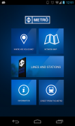
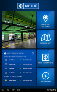
Funktionen und Ressourcen:
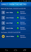
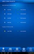
- Direkt von der Metro
Echtzeit-Tracking von jeder Zeile den Betriebszustand.
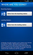
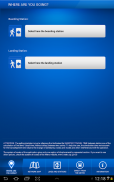
- Wohin gehst du?
Eine Schritt-für-Schritt-Simulation auf dem schnellsten Weg zwischen zwei Stationen, einschließlich der geschätzten Zeit-und Kostenaufwand, Nachbarschaft Maps usw.
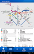
- Netzwerk-Karte
Visuelle Karte aller U-Bahnlinien.
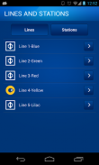
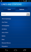
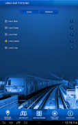
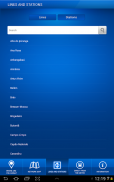
- Linien und Stationen
Alle U-Bahnlinien und Bahnhöfe. Consult Betriebsstunden, Standorte etc.
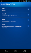
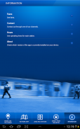
- Informationen
Anzeigen Tarife, Unterstützung Telefonnummern und Servicezeiten für einzelne Stationen.
São Paulo Metro - Official – Version 12.1.10
(18-12-2024)São Paulo Metro - Official – APK Informationen
APK Version: 12.1.10Paket: br.com.metrosp.appmetroNeueste Version von São Paulo Metro - Official
Weitere Versionen


Apps in derselben Kategorie

Das könnte dir auch gefallen...


